


Ames and Hogan Family Papers
Files
Download Full Text (154 KB)
Description
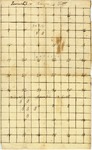
A surveyor's chart of a region in Oktibbeha County, Mississippi, labelled ''Township 18 Range 14 East'' and ''Township 17 Range 13 East''. Annotationsinclude squares designating land in T18/R14/S9 and T17/R14/S4-5 as ""B"" and other notations.
ISBN
2-F4-05
Publication Date
1880
Subjects
Surveying
Geographic Location
Mississippi
Object Type
text
Format (original)
document: 1 leaf; 19 X 31.2 cm.
Format (digital)
Digital ID
2-F4-05
Source
Mississippi State University Libraries, Manuscripts Division, Special Collections Department, Ames and Hogan Family Papers, Box 1, Folder 4
Digital Publisher
Mississippi State University Libraries (electronic version)
Rights
Copyright protected by Mississippi State University Libraries. Use of materials from this collection beyond the exceptions provided for in the Fair Use and Educational Use clauses of the U.S. Copyright Law may violate federal law. Permission to publish or reproduce is required.
Contact Information
For more information about the contents of this collection, email sp_coll@library.msstate.edu.
Recommended Citation
Ames and Hogan Family Papers, Special Collections Department, Mississippi State University
