

Hurricane of 1947 Aftermath Photographs
The 1947 Storm/Hurricane came ashore on September 19 as a Category 4 storm, one of the worst until Katrina. A Category 4 storm has winds of 131 to 160 miles per hour and a tidal surge of thirteen to eighteen feet, and damage is extreme. About three o’clock in the morning, the winds were clocked at 50 miles per hour; by eight o’clock, they were near 100 miles per hour. The storm’s eye passed over the Chandeleurs Islands and then over New Orleans. The Mississippi Gulf Coast was on the dangerous right-front quadrant and would receive severe damage from Pascagoula to Waveland. During the height of the storm, all power and phone service was lost, leaving no means of communicating with the outside world. The horrific winds and the power of the water were too much for framed structures. The Gulf Coast was isolated from rail traffic because 80 miles of the L&N Railroad was out of commission. The railroad bridges on Biloxi Bay and Bay St. Louis had been washed out. On Highway 90, both lanes were undermined in many places but especially the south lane. Numerous boats had washed ashore and lay within the debris of piers, businesses and homes.
-

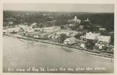
Air View of Bay St. Louis the Day After the Storm
This black and white postcard features an aerial view of a buildings, a street, and the beach along the coast. The title along the bottom of the card reads "Air view of Bay St. Louis the day after the storm."
-

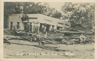
Debris Piled at a Shell Station in Biloxi, Mississippi
This black and white picture postcard features a Shell Service Station with piles of debris surrounding it. Several men are standing or seated on the debris. Trees are behind the building and the debris. The title along the bottom of the card reads "Debris piled at Shell Station, Biloxi."
-

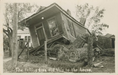
House Damage from a Hurricane, Gulf Coast, Mississippi
This black and white postcard features a shotgun style house tilted on it's side with fallen trees beside and beneath it. A handwritten title a the bottom of the image reads "The falling tree did this to the house."
-

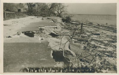
Hurricane Damage to the Coastal Road, Bay St. Louis, Mississippi
This black and white postcard features the washed out portion of a coastal road with debris on the beach after the 1947 hurricane. A handwritten title along the bottom reads "Title this storm picture yourself."
-

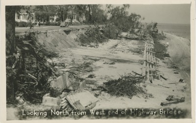
Looking North from West End of the Highway Bridge, Hurricane Damage
This black and white postcard features a view of the sea wall on the Gulf Coast after a hurricane. Debris litters the area. Homes and trees can also be seen on the other side of the street. The title along the bottom of the card reads "Looking North from West end of Highway Bridge."
-
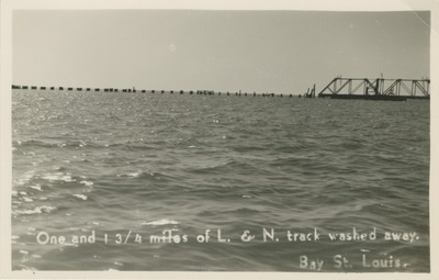
 Track Washed away. Bay St. Louis, Mississippi")
One and ¾ miles of L. & N. (Louisville and Nashville) Track Washed away. Bay St. Louis, Mississippi
This black and white postcard features a damaged railroad bridge over the open water. The title along the bottom of the card reads "One and¾ miles of L. & N. (Louisville and Nashville) Track Washed away. Bay St. Louis, Miss." The back identifies the item as a postcard and provides indication for correspondence, address, and postage stamp placement. The month and year is handwritten in the lower right corner.
-

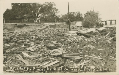
Pounded to Pieces by Wind and Wave, Corner of Ulman and Beach, Showing Road Washout, Bay St. Louis, Mississippi
This black and white postcard features a view of debris with a bridge in the distance and trees to the left. "Pounded to Pieces by Wind and Wave, Bay St. Louis, Miss." is along the bottom of the card.
